The Epic 150 #epic2016
http://www.strava.com/routes/4675113-
151.0mi
Distance
-
11,627ft
Elevation Gain
-
Road
Ride Type
Est. Moving Time:
10:03:44


Route recommendations may be incomplete and/or inaccurate and may
contain sections of private land and/or sections of terrain that could
be challenging or hazardous. Always use your best judgement about the
safety of road and trail conditions and follow traffic and property
laws.
Est. Moving Time based on your avg speed of 15.0 mi/h over last 4 weeks
| DIRECTION | DISTANCE (miles) |
|---|
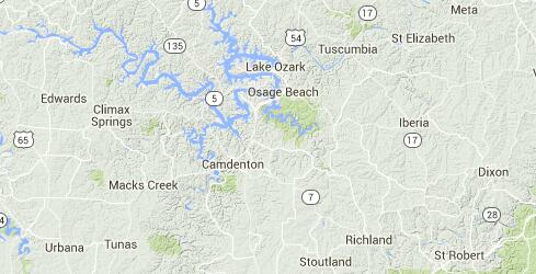
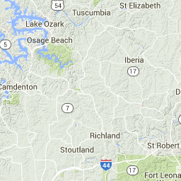
| Proceed | 0.0 |
| Left onto Ridle Road | 0.0 |
| Right onto Oak Bend Road | 0.5 |
| Proceed onto Oak Bend Road | 0.5 |
| Proceed onto Oak Bend Road | 3.4 |
| Proceed onto Oak Bend Road | 5.7 |
| Left onto Blackmer Road | 7.5 |
| Left onto Bear Creek Road | 9.4 |
| Proceed onto Bear Creek Road | 11.2 |
| Right onto Pea Ridge Road | 13.0 |
| Proceed onto Pea Ridge Road | 13.6 |
| Left onto Rock Quarry Road | 16.1 |
| Proceed onto Rock Quarry Road | 16.3 |
| Left onto State Highway C | 18.3 |
| Right onto Hawken Cemetery Road | 18.3 |
| Proceed onto Hawken Cemetery Road | 18.5 |
| Left onto Washington Drive | 18.8 |
| Left onto Gott Plantation Road | 20.0 |
| DIRECTION | DISTANCE (miles) |
|---|
| Proceed onto Gott Plantation Road | 20.6 |
| Left onto Howell Loop | 21.4 |
| Proceed onto Howell Loop | 21.4 |
| Right onto Bluebell Lane | 21.7 |
| Right onto County Side Road | 22.5 |
| Proceed onto County Side Road | 24.2 |
| Right onto Barren Branch Road | 25.1 |
| Proceed onto Barren Branch Road | 25.6 |
| Right onto 42 | 25.9 |
| Proceed onto 42 | 26.0 |
| Right onto State Highway U | 26.2 |
| Proceed onto State Highway U | 27.2 |
| Left onto Faith Community Road | 27.5 |
| Proceed onto Faith Community Road | 28.5 |
| Continue on Mulberry Road | 29.3 |
| Right onto Curry Road | 29.6 |
| Proceed onto Curry Road | 30.1 |
| Continue on Cajun Drive | 30.2 |
| Left onto State Highway EE | 30.9 |
| Right onto Oakbriar Lane | 30.9 |
| Proceed onto Oakbriar Lane | 31.3 |
| Right onto Rodeo Drive | 32.2 |
| Right onto Brush Lane | 32.7 |
| Proceed onto Brush Lane | 33.1 |
| Proceed onto Brush Lane | 34.0 |
| Right onto State Highway U | 34.2 |
| Continue | 34.6 |
| Left onto Buckeye Road | 34.7 |
| Proceed onto Buckeye Road | 35.5 |
| Proceed onto Buckeye Road | 36.7 |
| Right onto Blackoak Road | 36.9 |
| Continue on A-77A | 36.9 |
| Proceed onto A-77A | 40.0 |
| Left onto C36A | 40.7 |
| Continue on A-77A | 41.6 |
| Left onto Deans Creek Road | 41.9 |
| Proceed onto Deans Creek Road | 42.0 |
| DIRECTION | DISTANCE (miles) |
|---|
| Continue on State Road C | 42.5 |
| Right onto State Road A | 43.0 |
| Left onto A65 | 43.2 |
| Proceed onto A65 | 43.7 |
| Continue on South Wet Glazie Road | 44.2 |
| Proceed onto South Wet Glazie Road | 44.8 |
| Left onto Sharp Road | 45.7 |
| Proceed onto Sharp Road | 47.6 |
| Continue on State Road E | 49.2 |
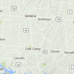
| Proceed onto MO 7 | 50.9 |
| Proceed onto MO 7 | 52.8 |
| Continue on Mill Creek Road | 53.2 |
| Proceed onto Mill Creek Road | 55.0 |
| Left onto North Davis Hollow Road | 55.3 |
| Continue on Carrol Cave Road | 55.9 |
| Proceed onto Carrol Cave Road | 56.8 |
| Left onto 7-65 | 56.9 |
| Proceed onto 7-65 | 57.5 |
| Continue on South Davis Hollow Road | 58.6 |
| Continue on 7-65G | 58.7 |
| Continue | 58.9 |
| Continue on 7-65G | 58.9 |
| Proceed onto 7-65G | 59.9 |
| Left onto MO 7 | 59.9 |
| Right onto Garman Hollow Road | 60.0 |
| Continue on Bb-20N | 62.2 |
| Proceed onto Bb-20N | 62.7 |
| Right onto Bb-28 | 63.8 |
| Proceed onto Bb-28 | 64.0 |
| Left onto State Road BB | 64.6 |
| Continue on High Point Road | 65.6 |
| Proceed onto High Point Road | 65.7 |
| Proceed onto High Point Road | 67.5 |
| Right onto Bb-35-X | 67.7 |
| Proceed onto Bb-35-X | 67.8 |
| Right onto Bb-80 | 68.6 |
| Right onto P-80 | 69.8 |
| DIRECTION | DISTANCE (miles) |
|---|
| Proceed onto P-80 | 70.0 |
| Proceed onto P-80 | 72.3 |
| Continue on State Highway P | 72.6 |
| Left | 72.9 |
| Right onto D-192 | 72.9 |
| Proceed onto D-192 | 75.8 |
| Continue on Misty Drive | 79.2 |
| Proceed onto Misty Drive | 79.2 |
| Right onto State Highway D | 79.4 |
| Proceed onto State Highway D | 81.4 |
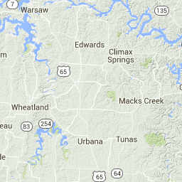
| Left onto Tunnel Dam Road | 81.9 |
| Proceed onto Tunnel Dam Road | 84.0 |
| Proceed onto Tunnel Dam Road | 85.5 |
| Left onto 54-98 West | 86.7 |
| Right onto U-110 | 86.9 |
| Continue | 86.9 |
| Continue on U-110 | 87.1 |
| Proceed onto U-110 | 88.1 |
| Continue | 88.8 |
| Continue on U-110 | 88.9 |
| Proceed onto U-110 | 90.3 |
| Left | 90.4 |
| Continue on Road 54-98 | 90.8 |
| Continue | 91.4 |
| Continue on Dry Ridge Road | 91.9 |
| Proceed onto Dry Ridge Road | 92.0 |
| Continue on Chapel Bluff Road | 92.9 |
| Proceed onto Chapel Bluff Road | 93.4 |
| Proceed onto Chapel Bluff Road | 97.3 |
| Continue on 54-98 | 97.5 |
| Left onto 54-98 West | 97.7 |
| Proceed onto 54-98 West | 98.6 |
| Continue on Tunnel Dam Road | 98.7 |
| Proceed onto Tunnel Dam Road | 100.9 |
| Proceed onto Tunnel Dam Road | 102.8 |
| Right onto State Highway D | 103.5 |
| Left onto Misty Drive | 105.9 |
| DIRECTION | DISTANCE (miles) |
|---|
| Continue on D-192 | 106.2 |
| Proceed onto D-192 | 108.1 |
| Proceed onto D-192 | 111.9 |
| Left | 112.5 |
| Right onto State Highway P | 112.5 |
| Proceed onto State Highway P | 112.8 |
| Proceed onto State Highway P | 114.3 |
| Right onto High Point Road | 114.8 |
| Continue on Snellings Lane | 115.3 |
| Proceed onto Snellings Lane | 117.1 |
| Proceed onto Snellings Lane | 120.9 |
| Left onto MO 7 | 120.9 |
| Proceed onto State Road E | 121.2 |
| Left onto Jefferies Road | 122.5 |
| Proceed onto Jefferies Road | 123.8 |
| Left onto Freedom Ridge Road | 125.3 |
| Proceed onto Freedom Ridge Road | 126.1 |
| Proceed onto Freedom Ridge Road | 127.3 |
| Right onto State Road A | 127.3 |
| Left onto Swinging Bridges Road | 127.8 |
| Proceed onto Swinging Bridges Road | 129.0 |
| Proceed onto Swinging Bridges Road | 130.3 |
| Continue | 130.3 |
| Proceed | 132.5 |
| Proceed | 133.2 |
| Continue on Swinging Bridges Road | 133.4 |
| Proceed onto Swinging Bridges Road | 134.4 |
| Proceed onto Swinging Bridges Road | 135.1 |
| Left onto 42 | 135.2 |
| Continue on County Road 42-16 | 135.6 |
| Proceed onto County Road 42-16 | 135.7 |
| Continue on State Park Road | 136.8 |
| Proceed onto State Park Road | 137.6 |
| Proceed onto State Park Road | 139.5 |
| Continue on Cassidy Road | 139.7 |
| Continue on Whispering Oaks Road | 140.6 |
| Proceed onto Whispering Oaks Road | 141.1 |
| DIRECTION | DISTANCE (miles) |
|---|
| Right onto Benton Road | 141.2 |
| Right onto Whispering Oaks Road | 141.3 |
| Continue on Kaiser Road | 141.4 |
| Proceed onto Kaiser Road | 141.9 |
| Proceed onto Kaiser Road | 142.7 |
| Proceed onto Kaiser Road | 143.3 |
| Right onto 42;134 | 143.4 |
| Proceed onto 42;134 | 143.5 |
| Left onto Blue Ridge Road | 143.8 |
| Proceed onto Blue Ridge Road | 144.8 |
| Proceed onto Blue Ridge Road | 145.4 |
| Right onto Oak Bend Road | 146.0 |
| Proceed onto Oak Bend Road | 146.2 |
| Proceed onto Oak Bend Road | 146.8 |
| Left onto Ballard Road | 147.3 |
| Proceed onto Ballard Road | 147.5 |
| Continue on County Road D-6A | 148.4 |
| Left onto Balboa Road | 148.4 |
| Right onto State Highway D | 148.4 |
| Proceed onto State Highway D | 148.5 |
| Proceed onto State Highway D | 149.4 |
| Proceed onto State Highway D | 150.1 |
| Proceed onto State Highway D | 150.8 |
| Continue | 151.0 |
| Arrive at Finish | 151.0 |