

(Click on an image to view it in a larger size)
For additional information, view the trail map and trail description prepared by the Missouri State Parks.
Comments
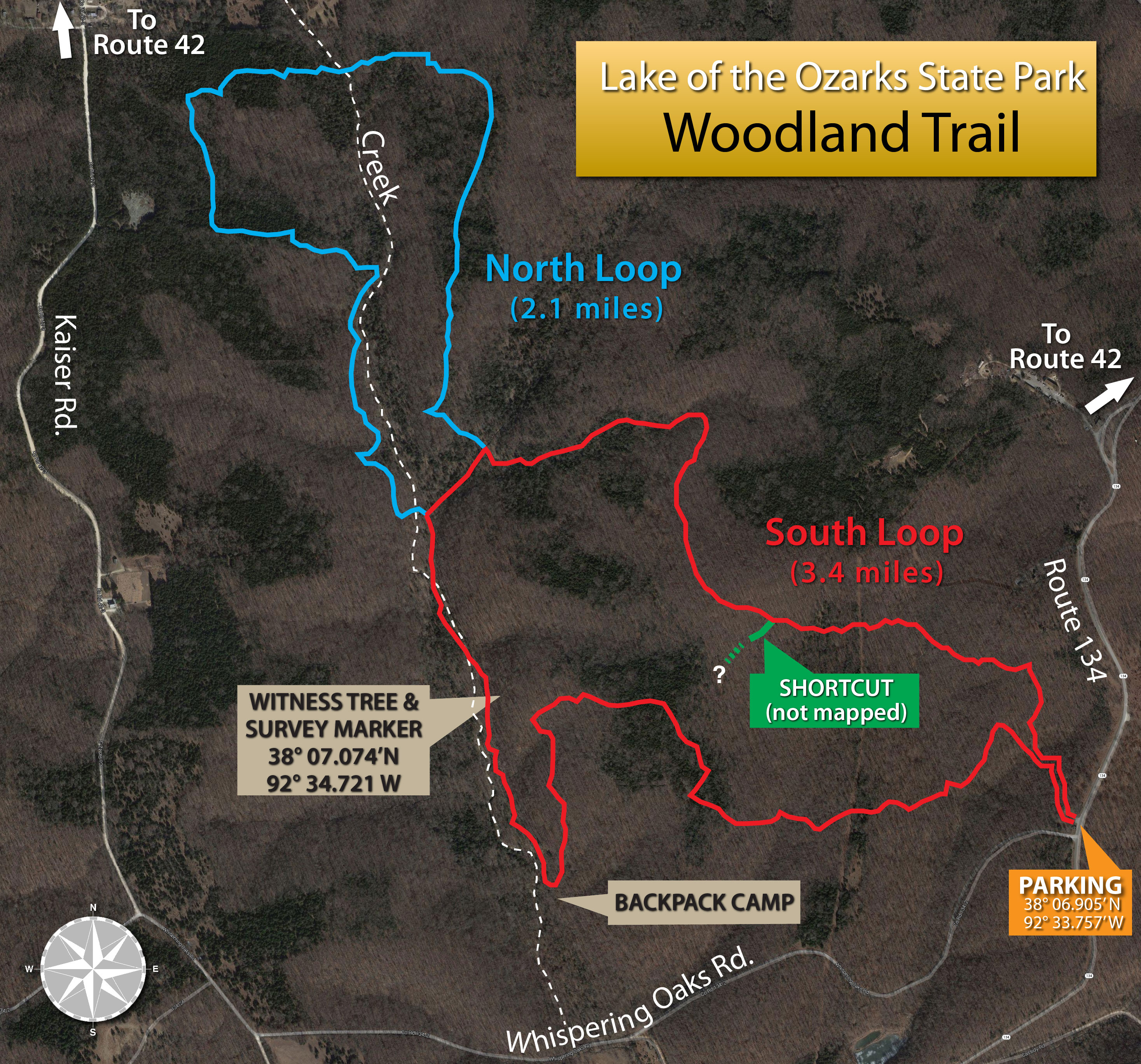
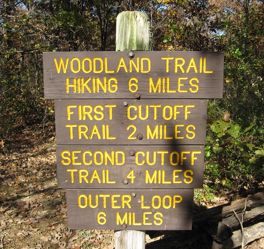
The Woodland Trail is a good hiking trail that features a wide variety of scenery, including tree-covered hills, grassy lowlands, and a mile-long section that follows a rocky creek bottom.
You can choose from several distances to hike. The most obvious are 3.4 miles on the south loop alone, or 5.5 miles, if you also include the north loop. You can also choose the north loop with an out-and-back on part of the south loop.
The trail isn't recommended for mountain biking. Local mountain bikers prefer the Four Winds Trail located a few miles south on Route 134.
The trail is marked with plastic tags nailed to trees along the route. In the fall and winter, when fallen leaves obscure the trail, it's sometimes necessary to pay close attention to stay on the trail.
Unlike some of the other trails in the state park, this trail has areas with evergreen trees (the darker areas in the above photo) that can help you figure out where you are.
A steady hike on the combined north and south loops (5.5 miles total) takes about 3-1/2 hours.
Photos
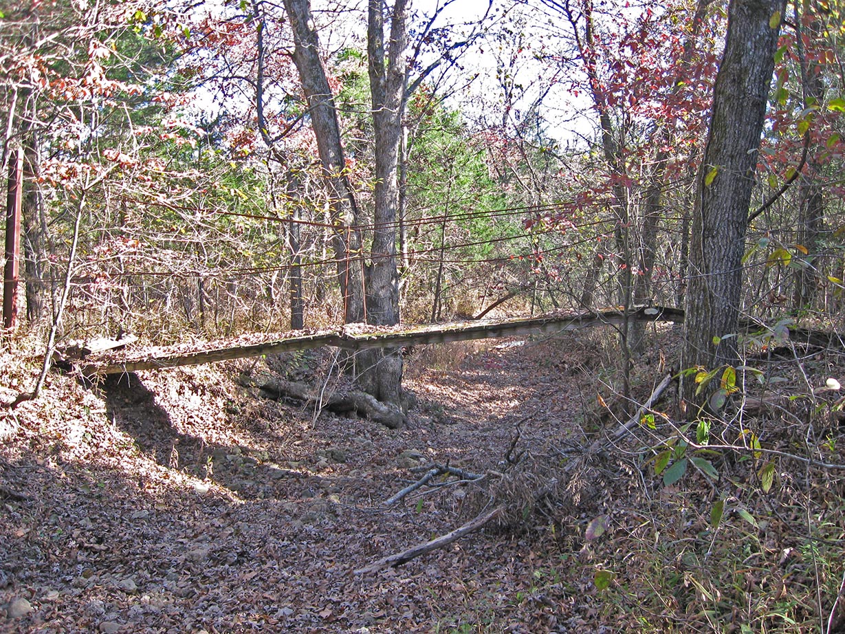
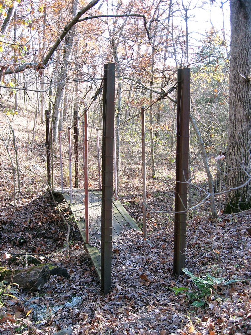
One of several cable bridges to be found on the trail. This one spans the creek in one of several crossing locations.
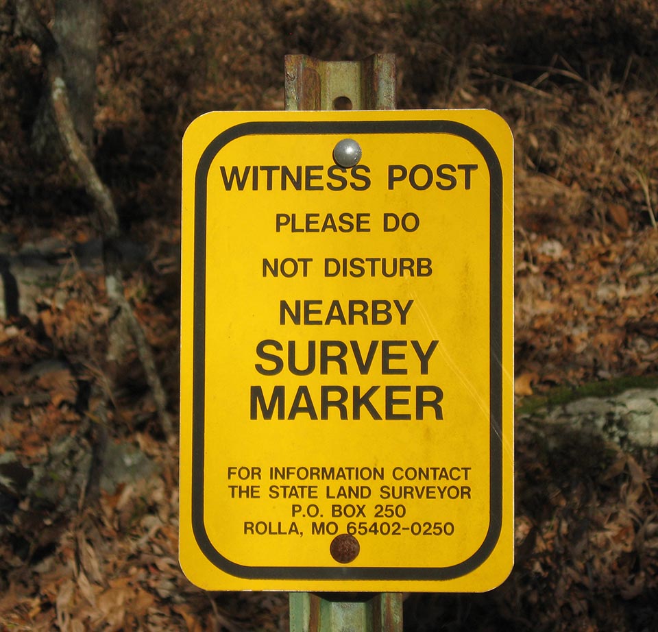
An important survey marker is located up a hill near the southern end of the south loop.
(I believe this and other markers in the state park were placed there in the early 20th century.)
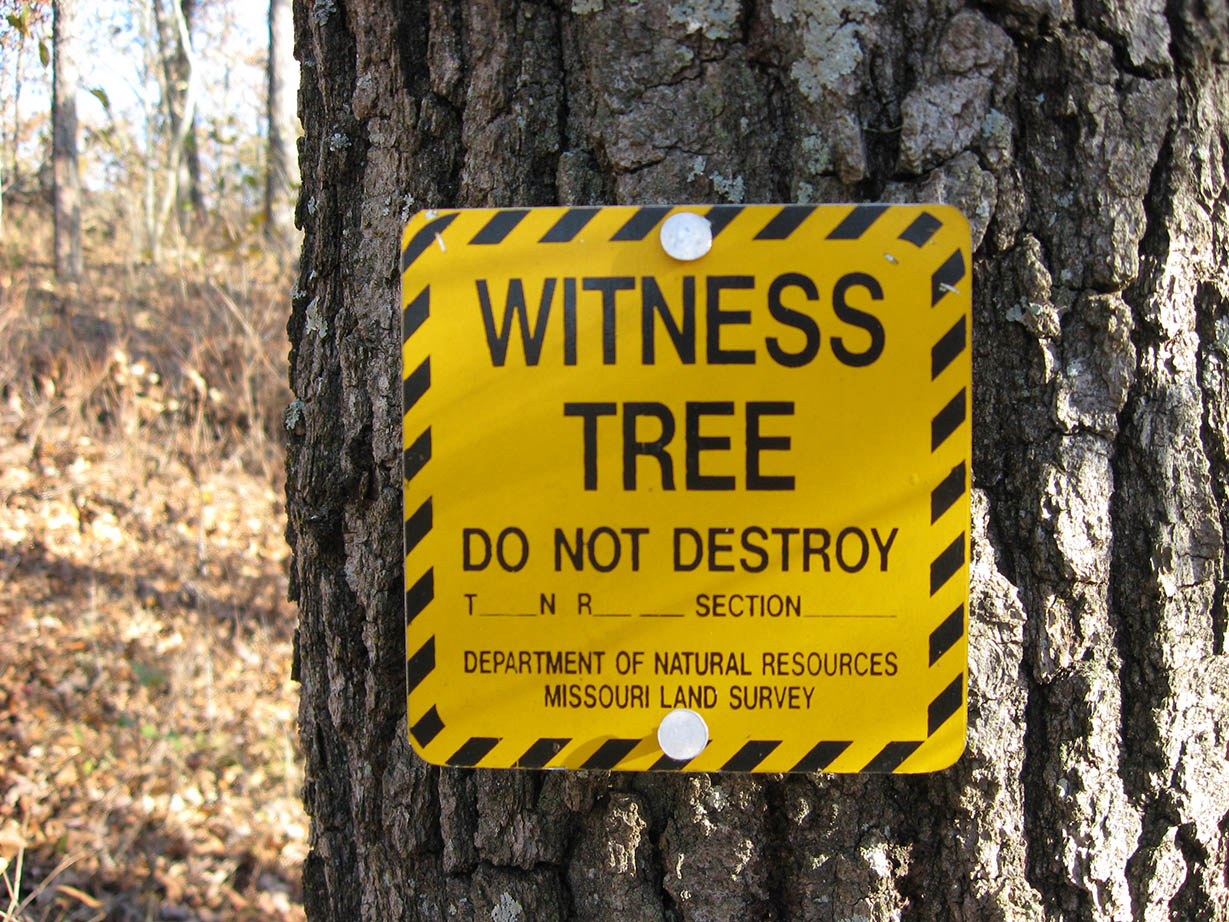
Near the survey marker was this "witness tree". The tree was pretty sizable, so it was probably 100+ years old.
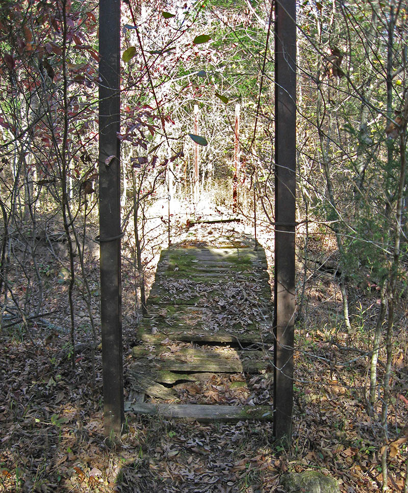
Another cable bridge, on the south loop.