

Honey Run Trail
(Click on an image to view it in a larger size)
For additional information, view the trail map and trail description prepared by the Missouri State Parks.
Comments
The Honey Run Trail is very popular among hikers and mountain bikers. While it's a longer drive for those living or staying in Osage Beach or Lake Ozark, it's well worth the drive.
There are three major sections of the trail, so you can easily match choose the distance you'd like to hike or bike with the amount of time you have available. The trail sections were designed to follow the contour of the land, so there's very little hill climbing.
The connector (2.6 miles) is the only section that isn't a loop. Thus, going out and back on it is a minimum 5.2-mile trip. A one-way, steady hike on this section takes about 1-1/2 hours. It takes a bit longer than normal due to some rough footing.
The south loop (2.3 miles) is the shortest, flattest and easiest section, and follows the creek bottom. This would be an ideal section if you're with children. This section took an hour to hike at a steady pace.
The north loop (3.7 miles) is great if you're looking for something longer. You can shorten it if you're willing to go off-trail, although that will likely mean climbing or descending a hill.
The north and south loops have some grassy areas where the tree canopy is sparse. From spring through fall, ticks can be expected in these areas.
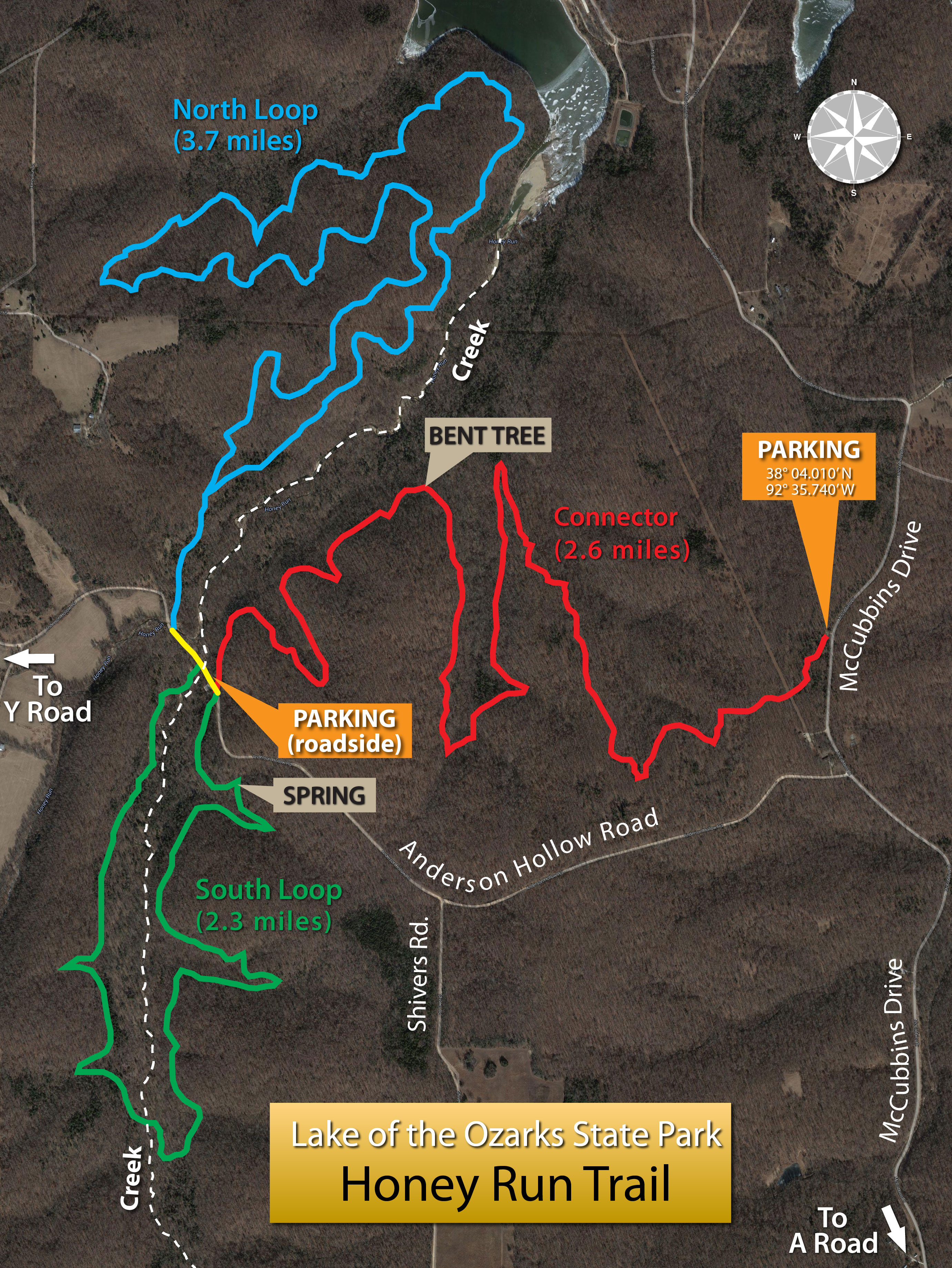
The bent tree is located at 38° 04.233' N and 92° 36.502' W.
The spring is located at 38° 03.772' N and 92° 36.844' W.
Photos
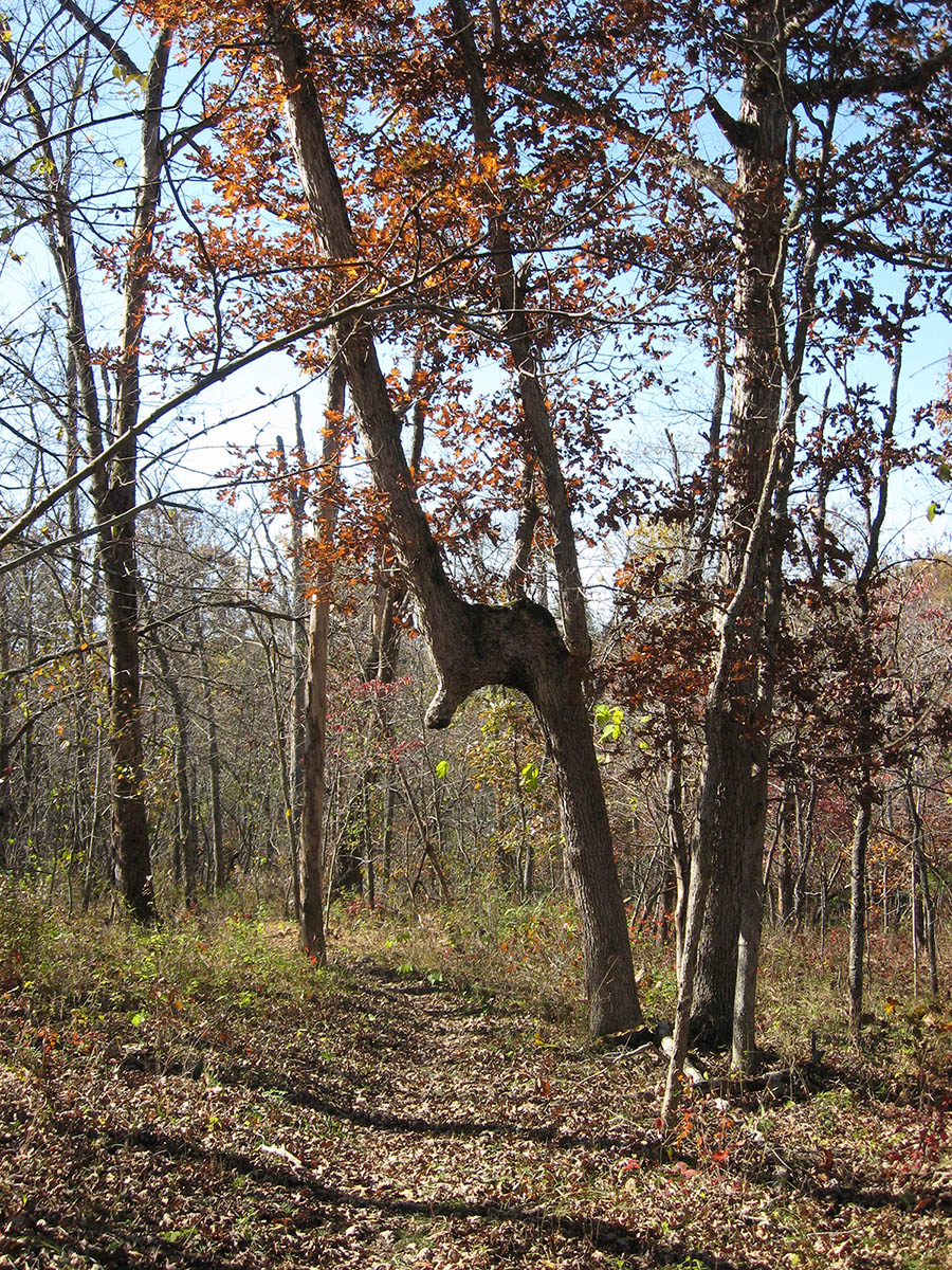
A rare sight in the state park--a bent tree. Although the history of this tree isn't know, Indians are known
to have bent trees to mark their trails. A cave located across the creek from this tree is believed to
have been used by Indians. Arrowheads have been found nearby.